NASA's Lunar Reconnaissance Orbiter (LRO) has been circling the Moon since June 2009, making it the longest-lived lunar orbiting mission in history. Flying in a polar orbit that completes a full lap roughly every two hours, LRO has produced the most detailed maps of the lunar surface ever made, and its data was central to confirming water ice at the Moon's poles.
This page tracks LRO's real position using NASA/JPL's own Horizons ephemeris system — the same data rendered live on SatFleet Live's interactive Moon map, alongside its orbital path.
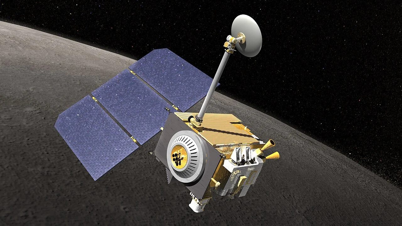
Quick Facts
| Mission name | Lunar Reconnaissance Orbiter (LRO) |
| Agency | NASA / Goddard Space Flight Center |
| Launch | June 18, 2009, Atlas V, Cape Canaveral Space Launch Complex 41 |
| Lunar orbit insertion | June 23, 2009 |
| Co-launched with | LCROSS (Lunar Crater Observation and Sensing Satellite) |
| Orbit type | Polar orbit around the Moon |
| Orbital period | Approximately 113 minutes |
| Mission status | Active — longest-lived lunar orbiting mission ever flown |
How This Live Data Works
The figures at the top of this page are not estimated or simulated. SatFleet Live queries NASA/JPL's Horizons system — the same ephemeris service used by planetary scientists — to calculate LRO's real position and altitude in real time.
On the Moon map, this same data is rendered as a moving marker with a traced orbital path over true lunar surface imagery, alongside Chandrayaan-2, Danuri, and every historic landing site from Apollo to Chang'e.
Mission Objectives
LRO was originally launched under NASA's Exploration Systems Mission Directorate with an exploration-focused mission: find safe landing sites for future missions, locate potential resources, characterize the Moon's radiation environment, and demonstrate new technology. In September 2010, after completing its primary mission, LRO was handed over to NASA's Science Mission Directorate for an extended science mission that continues today.
Its instruments have produced a high-resolution global topographic model of the Moon, mapped surface temperature day and night, characterized the radiation environment for future astronauts, and imaged the Moon's permanently shadowed polar regions in search of ice. LRO's data now also directly supports NASA's Artemis program, helping identify safe, resource-rich landing sites near the lunar south pole.
The Seven Instruments
Mapping the Moon: Key Discoveries
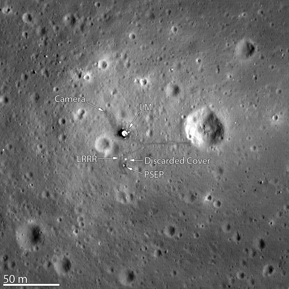
LRO's cameras have photographed every historic Apollo landing site in high resolution, revealing descent stages, scientific instruments left on the surface, and even the paths astronauts walked decades ago — imagery that remains some of the most widely viewed LRO has ever produced.
LRO's most significant scientific contribution came from its poles. Data from its instruments, combined with other missions, led to the direct confirmation in 2018 of water ice at the Moon's surface, concentrated inside permanently shadowed craters that never receive sunlight — most heavily at the south pole, with sparser deposits at the north.
Mission Timeline
- Jun 18, 2009Launch from Cape Canaveral aboard an Atlas V, co-manifested with LCROSS.
- Jun 23, 2009LRO enters orbit around the Moon.
- Sep 15, 2009Reaches its primary mapping orbit and begins its exploration-focused primary mission.
- Sep 2010Mission handed to NASA's Science Mission Directorate for extended science operations.
- 2018LRO data helps confirm definitive water ice at the lunar surface in permanently shadowed polar craters.
- 2026LRO continues operating as the longest-lived lunar orbiting mission ever flown, supporting landing site selection for NASA's Artemis program.
Frequently Asked Questions
Sources
- Lunar Reconnaissance Orbiter Missionscience.nasa.gov
- About LROscience.nasa.gov
- LRO: Observations for Lunar Exploration and Sciencentrs.nasa.gov
Explore More
See LRO moving live
Watch its real orbital path on an interactive 3D Moon globe, alongside Chandrayaan-2 and Danuri.
Open the Moon Tracker